
Measured Building Surveys
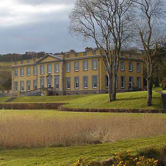
Siteline specialises in measured building surveys, producing accurate elevations, floor plans, cross sections and 3D models. These are typically commissioned by property owners or their architects or designers. They may range from simple floor plans used for space management or area referencing to highly detailed surveys for comprehensive redesign and refurbishment projects.
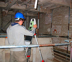
Our highly experienced measured building surveyors use market-leading software that records data graphically whilst on site and which produces visual and dimensional verification of the survey in real time. Increasingly, we’re using 3D laser scanning, particularly where complex and highly detailed features need to be represented with the utmost accuracy. This is particularly relevant to specialist conservation projects that involve historic and/or listed buildings, an area in which we have particular expertise.
Our teams have also been commended for their approach to surveying sensitive environments such as high dependency care homes, fully operational hospitals and educational establishments.
As an increasing number of our clients embrace the latest developments in Building Information Modelling (BIM), our investment in laser scanning technology and associated software ensures we continue to stay at the forefront of this ever evolving technology.
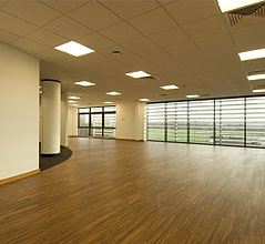
Area Referencing
Siteline’s independent area referencing services are relied on by property developers, architects and consultants and serve as the basis for commercial and residential property valuations and ratings.
Whether the requirement is for the measurement of Net Internal Area (NIA), Gross Internal Area (GIA) or Gross External Area (GEA), our experienced surveyors produce unbiased, factual reports, spreadsheet records and plans that comply with Code of Measurement Practice.