
Pre-Development Services
There are many elements to address within the pre-development process and our services extend beyond the usual topographical survey. This may involve the provision of supplementary information, such as the position and height of off-site trees and neighbouring buildings, additional highway data to determine access constraints or a utility survey for a detailed investigation into existing underground drainage and services. In some instances, there may be a requirement for street scene elevations or verified views for visual impact assessment and, if rights of light issues exist, this may require specific data to be surveyed on adjacent properties to allow the necessary calculations to be undertaken.
Flood Risk Surveys
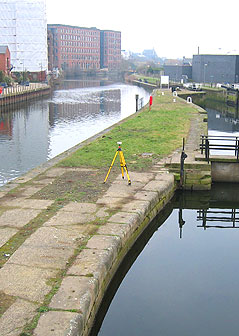
The planning process may demand that a flood risk assessment is undertaken and Siteline is highly experienced at providing the necessary level data to Environment Agency specification to support the process. This will usually involve the use of survey grade GPS equipment to accurately record existing levels to Ordnance Survey datum and may require an extended area survey to determine the possible extent of flooding or to identify a safe escape route from the site.
We’re also experienced at conducting surveys of larger watercourses, rivers, reservoirs and estuaries and have the use of various craft and sonar equipment where necessary. In particular, we can provide river cross section surveys for output to all proprietary flood modelling software.
Our confined space expertise also enables us to survey underground culverts as highlighted in our case study of the 1.5km Lady Beck culvert under Leeds town centre.
Verified Views
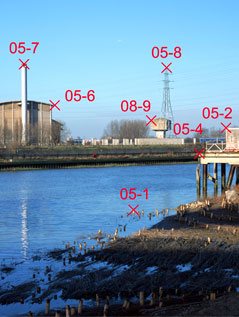
Verified views are increasingly being considered as an integral part of the planning application process for visual impact assessment. Siteline works closely with a number of digital imaging specialists to provide precise geo-referenced data. By recording 3D real-world coordinates for the camera’s focal point and numerous key points within the high definition photographic image, it is possible to integrate a CAD model of the design proposal accurately in to the image.
These images are relied on to provide not just realistic, but proven views of the proposed development in the context of the existing environment. Siteline has provided the measurement data for verified views used for many planning applications, appeals and public enquiries across London and the south-east.
Trees
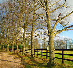
We’ve earned an enviable reputation for our topographical tree surveys (read our testimonials). We work closely with a number of authoritative arboricultural consultants concerning the mapping of trees for both general management purposes and, more specifically, for development and the planning application process.
We have also developed our own software to record tree canopies accurately in four directions and provide comprehensive tree schedules in Excel format, which meets the demands of BS 5837(2005) ‘Trees in relation to Construction’. The resulting schedule lists information on the species, stem diameter, spread and height of each, individually referenced tree and provides the basis for the tree condition report to be prepared by the arboricultural consultant.