
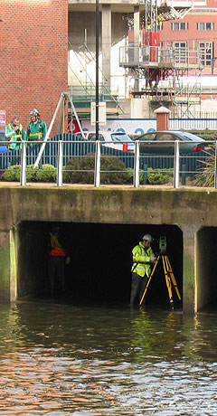
Siteline was commissioned by Hammerson to conduct a detailed survey of a 1.5km storm drainage culvert that runs beneath Leeds town centre to its discharge point at the River Aire. The project was controlled on the surface through a combination of GPS and total station and internally the full length was traversed by total station. In addition to the accurate plotting of the horizontal and vertical alignments, over 100 detailed cross sections were produced for the flood risk assessment.
Precise timings and specialist expertise were fundamental to the success of this survey; the structure is liable to flash flooding during heavy rainfall, so meteorological conditions were monitored closely. In addition, the entire culvert is designated as a confined space, so our own confined space trained survey team carried out the work with additional support provided by a team of four confined space experts. This helped the Siteline team to concentrate on the surveying which enabled them to complete the entire internal survey in just 4 days. With headroom of less than 1m in places and only six viable access points along the entire length of the culvert, this was a truly specialist survey project.
Siteline’s diverse expertise was called upon to provide additional services including a full CCTV and condition survey of the sewers and drains in the vicinity and an underground utility survey to locate the position and depth below ground of the services above the culvert.
If you need a confined space or other specialist survey, call us on 023 8081 1081 to discuss your requirements.
When Pinewood Studios Ltd embarked on a £200m project to develop the 46-hectare site that adjoins their existing Studios, Siteline was commissioned to conduct a detailed topographical survey and provide comprehensive survey data to support the numerous consultants’ design criteria. Our survey extended over some 67 hectares and included the accurate positioning of around 3,500 individual trees using specialist data capture technology; one survey team surveyed 2,000 trees in less than five days.
Siteline’s commission also included 6km of detailed highway survey to support the design of the infrastructure; to avoid the time and cost implications of out-of-hour working and traffic management, we used laser scanning technology to remotely capture survey data on busy junctions and roundabouts. Aerial photography was used to map the nearby M25 and M40 carriageways and slip roads to enable us to build a 3D model to be used for the acoustic impact assessment – essential to determine the possible effect of traffic noise on filming on the proposed studio sets.
If you need a specialist topographical or services survey, call us on 023 8081 1081 to discuss your requirements.
Siteline was commissioned to conduct a topographical route survey in advance of the design of a 3km replacement underground electric cable near Streatley in Berkshire. The project formed part of an on going National Grid scheme to replace ageing and inefficient sections of the Grid’s cable infrastructure. With the route passing over land in a number of different ownerships and with numerous ecological sensitivities we had plenty of logistical challenges to navigate.
The original planned route changed a number of times with each revision requiring additional survey work. Our broad expertise was again called on to provide further professional survey services to assist throughout the term of the construction project. This included the production of land ownership plans, easement plans and visual impact analysis for the proposed works at the sealing end compounds. As work commenced on site, Siteline prepared working drawings for temporary construction works at road crossings together with 3D modelling for directional drilling works and to determine required cable lengths.
In addition to setting out the entire route prior to commencement of works, regular visits were required throughout the two year project term to provide setting out services. This included the position of cable joint bays, setting out and service tracing at directional drill sites and at the sealing end compounds. Accurate as-built surveys recorded the position and level of the cables as they were laid and the project culminated in the compilation of the as-constructed record document in the client’s prescribed format.
If you need a services survey, call us on 023 8081 1081 to discuss your requirements.
BRE is an independent research-based consultancy, testing and training organisation committed to helping government, industry and business meet the challenges of the UK’s built environment. BRE offers impartial advice and expertise on every aspect of the built environment and associated industries to create better, safer and more sustainable buildings and communities.
Siteline conducted an extensive topographical survey of BRE’s 26-hectare site at Garston, which is home to many of the organisation’s research projects. Our survey was commissioned to provide detailed spatial data on the existing infrastructure that would support BRE’s ongoing and future development plans for the site.
If you need a topographical survey, call us on 023 8081 1081 to discuss your requirements.
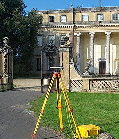
Broadlands in Romsey is the historic home of the late Earl Mountbatten of Burma and dates back to the 11th century Norman Conquest. Today the property is owned by Lord and Lady Brabourne and is open to the public for tours of the house, outdoor events and concerts.
Siteline has carried out a number of topographical surveys around the estate, notably to support the detailed design and implementation of a new landscaping and garden scheme. Siteline was commissioned by Taylor Tripp Associates, landscape and architectural designers.
If you need a topographical survey for landscape design, call us on 023 8081 1081 to discuss your requirements.
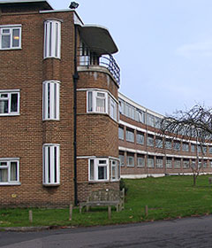
Siteline was commissioned to carry out a measured building survey and to produce detailed plans of Harefield hospital for the client, The Royal Brompton and Harefield NHS Trust.
Logistically and technically, this was a challenging survey project; more than 24,000m² of fully operational hospital areas were measured, including medical wards, administration areas, operating theatres, staff accommodation and research buildings. Further demands were made on our expertise due to the curved design of the main hospital building which required extensive internal instrumental control and an innovative approach to produce precise survey plans.
The project to survey Harefield Hospital was completed without disruption to staff and patients or loss of any facilities.
If you need a measured building survey, call us on 023 8081 1081 to discuss your requirements.
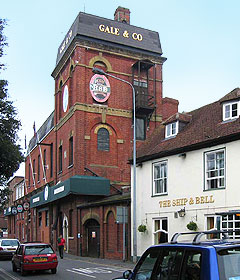
Siteline was commissioned by Fullers to conduct a full topographical survey of the extensive Gales Brewery site in Horndean to inform the design considerations for the future use of various elements of the property. As proposals for the project developed, we were subsequently instructed to carry out a detailed measured building survey to include Gale’s tower, a historic local landmark. As further areas of the site were brought to market, we prepared legal plans for the various transfers that followed.
Siteline has continued to provide surveying services with the preparation of further measured surveys to facilitate the development and regeneration proposals for the site.
If you need a pint, call us on 023 8081 1081 to discuss your requirements.


