
Precision Monitoring
Siteline conducts precision monitoring of structures and buildings, predominately in situations where faults have already come to light and monitoring has established that movement is still occurring. Alternatively, there are instances where major work, such as tunnelling or pile driving, is planned and monitoring will be carried out from before the work commences until long after it completes to ensure that no movement has occurred to structures within the vicinity.
We deploy various methods, depending upon circumstances, including 3D monitoring, precise levelling, laser scanning and remote sensing and we’re currently monitoring movement in a number of buildings using remote sensors, which provide real time GPRS data feeds via the mobile phone network.
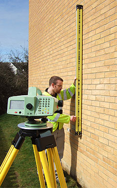
We use precise digital levels and laser equipment to monitor activity to sub-millimetre accuracy and produce detailed three-dimensional records to demonstrate and validate any form of deformation or movement; the results from our monitoring projects provide reliable evidence to site owners, developers and insurers.